 aterways. Oil Creek and Clover Fork are tiny tributaries far from the navigable portion of the Little Kanawha River. In fact, they drain the very edges of the Little Kanawaha's basin and most of the year it is hard to even see the current.
(For more on river basins and such, see the March 14 '96 entry, Geography For Flatlanders.)
Four miles from the confluence of Oil Creek and Clover Fork, they join the Little Kanawha at Burnsville. Still, the Little Kanawha is hardly navigable, although at times lumber could be floated downstream on it.
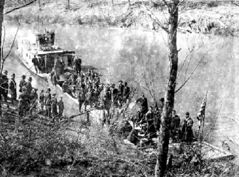
In the 1800s lockes were built to raise the water so that the Ohio River paddleboats could get as far up the Little Kanawha as Creston, now in Calhoun County. Getting further upstream required the use of flatbottomed push boats called bateau. About 1900 the gaspowered flatboat was invented, and they could push up as far as Glenville. This photo shows WWI soldiers boarding a gas powered flatboat at Glennville for the trip down the Little Kanawha on their way to France.
This information, the photo and much more can be found at Norma Knotts Shaffer's fine website Calhoun County's Little Kanawha River Valley http://freepages.rootsweb.com/~bradytrilogy/memories/images/bibliography/little-kanawha-river.htm]


No comments:
Post a Comment