 Roger Conrad provides this map of the Braxton County part of Orlando proper. Oil Creek Road into Orlando from Burnsville, turning sharply left on its way to Roanoke, has been colored dark red and the land belonging to the two churches, the white clapboard Methodist Church and the brick church that was St. Michael, are highlighted in yellow.
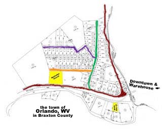
The area within the open triangle formed by Oil Creek Road is a bluff shown from the side in the photo below the map. The photo was taken from downtown Orlando, east of the bluff.
The big surprise to a casual visitor is that there are three named streets up on that bluff! Back in the day there seemed to be only Oil Creek and Clover Fork Roads in Orlando with actual names. Wonder how the names came about. Highland Street makes sense because it is, after all, on high land and Church Street is probably where the United Brethern Church was. But where did they get "Academy"? Was the 3 room Orlando school located there?

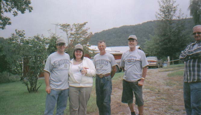
A nice little neighborhood thrives on that Braxton County bluff overlooking (the former) Downtown Orlando. The Skinner/Stutler cousins meet there on Labor Day Weekend. (Shown in photo below.)
P.S., while we're talking about street names, regarding Downtown Orlando (located in Lewis County, east of this Braxton County Orlando map):
A sign posted downtown declares the (only) street running off Clover Fork is named Cemetery Road. While it does go past the road to the cemetery, couldn't they have named it Dolan Street or Confluence Road? Or Oras and Edith (Skinner) Stutler Parkway?


No comments:
Post a Comment