Over many millennia water eroded this flat Appalachian Plateau, cutting valleys averaging, maybe, 300-500 feet. That may not be very high for a mountain, but the craggy erosion through rock and mineral made for a very rough, inhospitable terrain. According to my reading, peaks on the plateau are considered mountains. However, I’ve never heard them called anything but hills so I will call them hills. Another feature of this plateau-turned hill region is that the tops of the hills tend to be remarkably level, in places forming ridges that are easier to travel than some of the lowlands.
Back to the millennia far before history, the water cutting into the plateau trickled into freshets and little streams which met up to form creeks which combined to form rivers, all of which fed the Ohio River. The area drained by a river is considered that river’s watershed, or basin. Follow a river back through the streams to the place in the hills where the water begins to flow and you've come to the headwaters of the river.
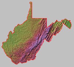
So, these many millennia later we have maybe a half dozen rivers with watersheds draining 3/4 of West Virginia into the Ohio and the ridges that separate these watersheds are made up of hills far more level than you’d expect mountain peaks to be. In particular is the Bison Ridge that separates the Little Kanawaha River basin from the Elk River basin.
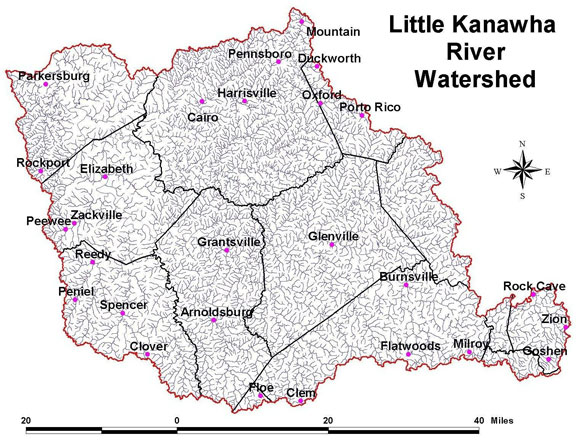
Orlando is situated near the edge of the Little Kanawaha (kan' aw) River’s watershed, at the confluence of two relatively small and certainly unnavigable creeks: Oil Creek and its Clover Fork. About four miles downstream their waters meet the Little Kanawha River at Burnsville. The Little Kanawha continues on a rather northwesterly route, through the towns of Gilmer, Glenville, Creston, Palastine, Slate and Davisville, picking up more strength from other runs and creeks as it goes, and empties into the Ohio at Parkersburg. The Little Kanawha becomes consistently navigable at Glenville.
Again back to times before history, before humans, in the hills there were fresh and saltwater springs and other permanent features attractive to animals. Animals, the buffalo in particular, traveled from one feature to another, finding the easiest route between them and beating the earth into easily traveled roads. When humans came along, they used all these features, land and water, to travel. Sometimes it was easiest to walk along some of the high ridges, sometimes along the buffalo roads or down along shallow streams. When water was deep enough, canoes would lighten and speed their journeys.
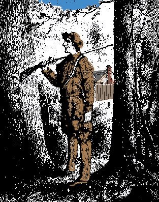
This is what the first European explorers, like Thomas Hughes pictured here, found when they arrived on the scene on the mid and late 1700s. Each mode of European travel has built on these early roads. Wagon roads followed the Indian paths, Railroads made particular use of the stream beds and autos used both the wagon roads and railroad beds. Locks and canals made travel by boat easier. Shadows of these origins can be seen even in today’s expressways.
It is useful to note that state and county lines sometimes use the waterways and ridges as boundaries, but the two systems, natural and political, follow very different logic.
Two things are certain. First, each new mode of transportation echoes these origins as well as pressures from political and commercial interests and second, each creates a new reality for the folks along the way. Orlando, West Virginia is an excellent case in point.
The sketch sbove is one of Central West Virginia's self-styled European explorers, Thomas Hughes, who walked the riverbeds, ridges and buffalo paths throughout this area. The sketch was drawn under the guidance of an acquaintance of Hughes’.
bibliography
Shaffer, Norma Knotts. several web articles about the Little Kanawaha and the town of Creston. See http://freepages.rootsweb.com/~bradytrilogy/memories/images/bibliography/little-kanawha-river.htm
Sutton, John. History of Braxton County and Central West Virginia. McClain Orinting, 1919.


No comments:
Post a Comment